Wednesday, December 29, 2010

What have you done this month outside of your normal classroom instruction?


Blogging has helped me document collaborations that I have done to enrich my own professional development or enrich the projects of my students.

Students: A group of students that I am advising on an engineering project met with an Athens Engineer this month to look at their designs for a wind energy project they are working on for a Skills USA competition spring 2011....... we can't give any details right now as we are still in the design stages :) Our guest engineer came with the help of the folks at the Voinovich Leadership School STEM program at Ohio University, Athens, Ohio. www.voinovichcenter.ohio.edu


A first for me this month was working in the exhibitor's hall at the regional NSTA convention held in Nashville, TN. Wow, that is one busy place! As a teacher I have walked through the isles going from one booth to another, kind of like teacher trick-or-treat, but it is so different on the other side.

I worked in the NOAA booth with some FABULOUS people and I learned many new things.

The folks at the NOAA education office have many great resources for teachers - check it out! www.education.noaa.gov

For me, I learned some history on weather maps, the difference between El Nino and La Nina (Thanks Dennis!), a new way to do a lab demo I have done for years, and that teachers from all over Nashville were excited to see the NOAA booth and the resources they offered.

Monday, November 29, 2010

Get on the horn and call your friends: NOAA TAS Deadline Tuesday Nov 30!!


photo: calling home in my room aboard the Oregon II before shipping out

www.tas.noaa.gov

Don't miss out on this great experience!!

Hints:
Check all boxes that you will travel anywhere,
Check all boxes that you will go on any mission,
Check boxes that you will travel no matter how many days the mission,
Limit the dates that you can't travel,
If you can travel during the school year LET THEM KNOW.

I actually checked the box that stated 'under 2 weeks', but sometimes things happen and my mission was changed to 17 days. I took it anyway b/c this is a very competitive application and I didn't know if I would get selected again + the missions were filling up fast.

Good Luck!!

Saturday, November 13, 2010

On the other end

So, I have mentioned that anytime you go somewhere, take down names. Sounds like a police investigator, but no matter where you are you can find an idea for your classroom or your professional development.

Today I took my son to Ohio University for the Ohio Chemistry Contest, and there I ran into a teacher I met summer 2009 at a STEM workshop. We talked about some of the projects that we have done since the STEM commitment and he mentioned his involvement in the Ohio Riverboat (?) Project. (WISH I HAD HEARD ABOUT THIS ONE EARLIER). We shared some macroinvertebrate sampling stories, but what kept going through my mind was: This teacher needs to apply to the Teacher At Sea Program. I gave him the information and I think he may apply.

I try to inform any teacher I know about the opportunity because that is how I found out, from another teacher that I shared a table with at a random science OGT (Ohio Graduation Test) meeting.

Networking has always been a top priority of mine, and with today's technology it is hard not to network!

Thursday, October 21, 2010

Ahhhh, the sea calls

Today I finally posted my post-survey form on the TAS training website. As I was filling out my post-survey many memories came back to me.

This week I presented my TAS experience at my local chapter of the Delta Kappa Gamma Society (an professional organization for teachers and retired teachers). I have been a member for three years and each year I have been able to present some kind of professional development that involves travel. The ladies enjoyed the presentation and I tried to encourage some to apply for the TAS program.

During the dinner portion I passed around my photo book that I created on a photo website. These can make great souvenirs and journals. If you would like to do a lot of journaling you will want to research the best photo book for you as the one I used had a limit to the amount of type that could go on a page.

During presentations, I tend to ramble on at times so I created a DVD with photos and video of my trip which I overlaid voice recordings to explain the footage. This kept my presentation under 20 minutes. It was very difficult to take 17 days of experiences and compress into that small amount of time. Afterwards I had a question and answer session.
One question that was asked, "Would you do it again?" My answer, "YES!!!!!" After I complete my Global Field Program in Zoology I would like to volunteer time with NOAA and their fisheries department. It is hard work, but the environmental stewardship and the opportunity to 'do science' is a wonderful experience.

I will be presenting my TAS experience again in February at the SECO (Science Education Council of Ohio) annual conference in Akron, Ohio.

Monday, July 19, 2010

Home Sweet Home


One of the sharks we caught in our trawls.

I am still working on 'decompressing' from such an awesome experience aboard the NOAA ship, the Oregon II. When I hit the bed Saturday night I think I was out within 5 minutes. And to think, the crew and scientists aboard NOAA ships do this job over 200 days a year.

Thursday night before we arrived in Mississippi I woke up at 2100 hrs (9:00 pm) and thought I would take a look outside. The waters were still and looked like black glass. A crescent moon was shining over the gulf, and the stars were so abundant and bright. It was the most beautiful night I had seen since my July 1 voyage began.

Friday night was my last night on ship and I tried to stay awake to see the glow from the fires of the Deep Water Horizon..... but my body gave out to sleep. However, each night and day I could see oil rigs all along the voyage, especially Friday when we were traveling through "oil rig alley". I could not get over how many rigs were out there, which you can find many maps online that show where oil rigs are located.


Saturday at 0400 hrs (4:00 am) I woke up, I could feel the ship not moving. We were sitting outside of Pascagoula waiting until daybreak when we could start moving into shore. When a ship is going to dock all of her colors will fly. When out to sea the only flags on the masts are the MS flag, the NOAA flag, and the US flag.

Once we docked everyone was busy, I didn't get a chance to get a photo with the entire scientific party. We had 17 days together but we working so much a photo op didn't cross our minds. In this photo is Geoff and Sean from the NE labs, me, Bruce the other TAS, and Abbey - my roommate and a senior at the University of MN.

I hope to keep in touch with the entire bunch, you never know when another collaboration will surface.

Thursday, July 15, 2010

One more day for me, many more days for the scientist who monitor our seas


Birds, Sharks, Fish, Water Chemistry……. Everything needs to be monitored for the ‘big picture’

NOAA Teacher at Sea: Kimberly Lewis
NOAA Ship: Oregon II
Mission: SEAMAP Summer Groundfish Survey
Geographical Area of Cruise: Gulf of Mexico
Date: Wednesday July 14, 2010

Weather Data from the Bridge
Time: 1115 (11:15 AM)
Position: Latitude 28.59.313 N, Longitude 94.28.958 W
Present Weather: partly cloudy
Visibility: 8 nautical miles
Wind Speed: 11.21 kts
Wave Height: 3 feet
Sea Water Temp: 29.7 C
Air Temperature: Dry bulb = 30.1 degrees Celsius; Wet bulb = 26.3
Barometric Pressure: 1017.50 mb

Science and Technology Log
(this log is a little lengthy, but very important concepts)

Southeast Fishery Bulletin released a statement on July 12, 2010 regarding the Shrimp Fishery to re-open on July 15, 2010 off the coast of Texas. Data that we have been collecting on board the Oregon II is sent daily to the regional office for review. From our data over the past week and data collected by the Texas parks and Wildlife Dept, the NOAA Fisheries Service has announced the size of the brown shrimp have reached a mark that allows the trawling to re-open from 9 to 200 nautical miles off Texas.

The shrimp fishery is closed annually off Texas to allow brown shrimp to reach a larger and more valuable size prior to harvest, and to prevent waste of brown shrimp that might otherwise be discarded due to their small size. http://sero.nmfs.noaa.gov/bulletins/fishery_bulletins.htm

During our sampling I have personally seen many sizes of shrimp. The past few days the brown shrimp have been very large. Personally, I have not seen shrimp this large before…… but living in Ohio most of our shrimp comes frozen and already beheaded.
When sexing shrimp the larger shrimp are usually female. This is the case with many species of organisms. As we are counting through the first 200 shrimp for data collecting, you can almost guess before looking what the sex of some shrimp will be just based on their size.

Tuesday the idea of whole ecosystem-based management was addressed.

An article by Hughes (2009) shows a relationship between species of seagrass and the species that they provide with habitat and/or food source. The data shows the importance of an ecosystem-based mgmt approach that incorporates interdependencies and facilitation among species (Hughes et al. 2009). This is the concept that is taking place by the US National Marine Fisheries Service (which is a department within NOAA) in relation to the "essential fish habitat" which approaches the protection of sea-grasses (Hughes et al. 2009).

What about the IUNC (International Union for Conservation of Nature) Red List? As of now, threats to biodiversity are often listen on a species-by species basis (Hughes et al. 2009). The research in the Hughes (2009) article suggests looking at connections between threatened species and their habitats...... ecosystem-based conservation. Again, the NOAA fisheries have already started this trend.

Some things that are done on the NOAA fisheries ships to maintain low variables throughout the years of sampling are keeping the same gear and using the same sampling methods. As far as site selection, the stations are random stratified. An example of this would be not going to the same station year after year, but sampling 20 stations in Area A. So the following year it may be another random 20 stations in Area A.

Habitat quality also plays a role in sampling. Commercial fishermen may question why NOAA chooses to sample in a place that has low or no fish, but it is important to monitor all areas. As the high quality habitat looses fish due to the fishing industry, fish from another area will move in. At first glance it may seem like the populations are fine, but if the other areas are being depleted because fish are moving into the prime area you start to see a shift in an ecosystem.

Here in the gulf we are not seeing any invasive species in our sampling areas, which is great news. A few years back some Australian jellyfish were making their way in, but you mainly see those closer to the coast. We have had good catches while we have been out, in other words a good proportion of organisms based on the depth of the water.


"Sorting the Catch"


So finally what can I say about ecosystem management? Hooray for the US Nat'l Marine Fisheries!


Works Cited:

Hughes, R. Williams, S. Duarte, C. Heck, K. Waycott, M. 2009. Associations of concern: declining seagrasses and threatened dependent species. Frontiers in Ecology and the Environment: Vol. 7, No. 5, pp. 242-246.

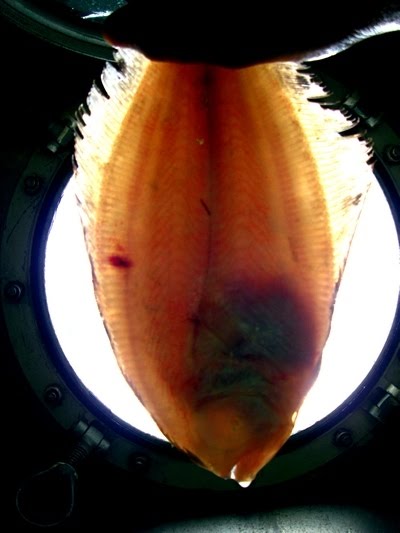
"Shrimp, eels, various fish, etc."


Personal Blog:

We have finished up our Texas stations and we are headed to the Louisiana west delta. I have been scrambling around to get some good photos of the lab, the sea, etc. because it has hit me that I only have two more days on the boat.

Usually journaling and photo taking come easy for me on my summer expeditions, but this one has really been a lot of work. With 12 hour shifts and trawling happening all throughout the night, there is not much down time. Which is probably fine b/c you are in the middle of the sea on a boat. What else would you do? This isn’t a Carnival cruise line. Hahaha.

I have really adjusted to sea life and night shift. Each day when I get off of my shift I hit the bed hard…… and don’t wake up until 10pm!

Chefs Walter and Paul have continued to feed us all well, too good at times. Everyone on the ship has kept their day 1 attitude and hospitality toward me and the other volunteers. It can be tough living in a small place, but it seems to work well on the Oregon II.

Wednesday, July 14, 2010

Wed July 14, 2010 : the nightshift is running smooth


The sunrise is here and we are caught up on processing our catches. I may go try to grab a bite to eat before we get to the next station. I will be setting the CTD for a DO (dissolved oxygen) sample to do a titration. Hopefully when the boat is still and the CTD is down I will get a cool photo.

Tuesday, July 13, 2010

Ecosystem Conservation and some of the people who monitor it


NOAA Teacher at Sea: Kimberly Lewis
NOAA Ship: Oregon II
Mission: SEAMAP Summer Groundfish Survey
Geographical Area of Cruise: Gulf of Mexico
Date: Tuesday, July 13, 2010

Weather Data from the Bridge
Time: 1130 (11:30 AM)
Position: Latitude = 28.57.59 N; Longitude = 94.49.73 W
Present Weather: Clear
Visibility: 8-10 nautical miles
Wind Speed: 14.97 knots
Wave Height: 4 feet
Sea Water Temp: 29.1 C
Air Temperature: Dry bulb = 31.4 C; Wet bulb = 27.0 C
Barometric Pressure: 1013.77 mb

Science and Technology Log

“IT’S ALL CONNECTED.” Everything in an ecosystem is connected to everything else. This is a guiding principle of studying and managing ecosystems. This past spring in one of my online communities we were discussing whole ecosystem monitoring for conservation rather than the traditional ‘save one species at a time”.

I’m seeing it now in the Gulf of Mexico. Obviously, the ocean environment is connected to human activities – the BP-Deepwater Horizon oil spill makes that abundantly clear. But there are also countless natural connections, and much less obvious human impacts, that must be understood and assessed if the Gulf ecosystem is to be protected. Commercial fish and shrimp stocks can only be sustained through a careful understanding of the human impact and natural connections in the Gulf.

That’s why we identify and count every organism we bring up in a trawl. Sometimes we get 50 or more different species in one catch, and we don’t just count the commercially important ones like red snapper and shrimp. We count the catfish, eel, sea stars, sea squirts and even jellyfish we haul in. Why? Because even though these organisms might seem “unimportant” to us, they might be important to the red snapper and shrimp. They also might be important to the organisms the red snapper and shrimp depend on. And even if they’re not directly important, studying them might tell us important things about the health of the Gulf.


Bruce and I are learning a lot about this from the incredibly knowledgeable marine biologists in the science party. Brittany Palm is a Research Fishery Biologist from NOAA’s Southeast Fishery Science Center (SEFSC) in Pascagoula, MS, and leader of the day watch on this leg of the Oregon II’s Summer Groundfish Survey. Brittany is working on her M.S. on a fish called croaker, Micropogonias undulatus, studying its stomach contents to better understand its position in the food web. Croaker is not an economically important species, but it lives in the same shallow sea floor habitat as shrimp so shrimpers end up hauling in a huge amount of croaker as bycatch. So, when the shrimping industry declined in 2003-2004, the croaker population exploded. Since croaker are closely associated with shrimp habitat and the shrimp fishery, we might gain important insights by studying croaker population and understanding what they eat, and what eats them.


Alonzo Hamilton is another NOAA Fishery Biologist from the SEFSC. Alonzo explained that there’s a lot to be learned by looking at the whole ecosystem, not just the 23 commercial species that are managed in the Gulf. For example, many of the crabs we commonly catch in our trawls are in the genus Portunas, known as “swimming crabs.”


Portunas species normally live on the sea floor, but when severe hypoxia sets in, Portunas crabs can be found at the surface, trying to escape the more severe oxygen depletion that typically takes place at the bottom of the water column.


Sean Lucey and Geoff Schook are Research Fishery Biologists from NOAA’s Northeast Fishery Science Center in Woods Hole, Massachusetts. They are working on the Oregon II right now to support the SEFSC because of huge manpower effort demanded by the oil spill. The NEFSC has been conducting their groundfish survey annually since 1963, making it the longest-running study of its kind. Originally the survey only looked at groundfish population, but as our understanding of ecosystem dynamics increased over time, more and more factors were analyzed. Now NEFSC looks at sex, age, stomach contents and many other species besides groundfish to obtain a more complete picture of the food web and the abiotic factors that affect groundfish. NEFSC even measures primary production in the marine ecosystem as one tool to estimate the potential biomass of groundfish and other species at higher trophic levels.


Andre DeBose is a NOAA Fishery Biologist from the SEFSC and the Field Party Chief for the Summer Groundfish Survey. In addition to leading the science team on the Oregon II, Andre is conducting research on Rough Scad, Trachurus lathami, an important food species for red snapper and important bait fish for red snapper fisherman. By gaining a better understanding of the relationship between Red Snapper and its prey we can better understand, and better manage, the ecosystem as a whole.

There’s a lot of information to be learned beyond just counting fish. By taking a wide look at the marine environment we can better understand how the whole ecosystem functions. This enables us not only to be more informed in setting sustainable catch levels, but also enables us to identify and respond to things that contribute to hypoxia and other problems that degrade habitat and reduce populations. It’s all connected.


Personal Log


Everyone in the scientific party has been working very hard to gather data. A 12 hour shift can be long at times, and other times fly by. Today Andre told us we will start cleaning up Thursday morning. It doesn’t seem possible that my 17 days with the Oregon II will soon be over. Part of me is excited to get back home to see my family and sleep in a bed that isn’t affected by the Gulf waves. The other part of me is sad due to the fact I will not longer be working with some remarkable people and worked with ongoing scientific research. It is very hard work, but very exciting to see what goes on at sea. I am sure I will call on some of them in the future for collaboration.

Chef Walter made some great meals over the past few days. Crab cakes, roasted buffalo, chicken curry, and quail, not to mention those great breakfasts. Based on my first two days of sea not able to keep anything down and not wanting to eat, I thought for sure I would go back to Ohio 15 pounds lighter. But the sea sickness wore off and I am enjoying food and adjusting to boat life.

Monday, July 12, 2010

National Seafood Inspection Lab


NOAA Teacher at Sea: Kimberly Lewis
NOAA Ship: Oregon II
Mission: SEAMAP Summer Groundfish Survey
Geographical Area of Cruise: Gulf of Mexico
Date: Sunday July 11, 2010

Weather Data from the Bridge
Time: 0730 (7:30 am)
Position: Latitude 28.18.6 N; Longitude 95.19.4 W
Present Weather: party cloudy
Visibility: 10 nautical miles
Wind Speed: 12.35 knots
Wave Height: 2 feet
Sea Water Temp: 28.9 C
Air Temperature: Dry bulb = 29.1 degrees Celsius; Wet bulb = 25.4 C
Barometric Pressure: 1014.30 mb

Science and Technology Log

What is science technology? One simple definition can be ‘tools to help humans do science’. We have talked about some of the tools used aboard the Oregon II, like FSCS and CTD, but what are some other tools used that are not high tech?
Believe it or not, a shovel is an important tool on the ground fish survey. When a catch comes in, the net hovers over empty baskets and the catch is slowly released to fill the baskets. Once all of the catch has been emptied from the net, shovels are used to pick up the rest of the catch from the deck that fell out during emptying. In the wet lab we use scrappers to move the catch along the tray where we sort the organisms. When it comes to identification paperback field guides and laminated posters can help with ID.

So what do we do with the organisms we collect data on and identify?
It was mentioned that the SEAMAP survey collects data for many different agencies, but during the data collection we also save specimens for scientist from universities and other research groups. If a scientist is doing research on a particular species of batfish for example, once we collect data on the batfish we print a label for that scientist, bag the fish in zip loc baggies, and then put the specimens in the freezer below deck.


Station board – stations with a star beside them are NSIL stations. Stations with a “B” are stations where we drop the bongo nets (mentioned in an earlier log).


For commercial seafood we bag specimens to go to NSIL (National Seafood Inspection Lab). Not every station we drop the nets for is a NSIL station, but when we do have a NSIL station we follow a similar sample saving protocol to the one used for research scientists. These samples get labeled, placed in zip-loc baggies, and then they’re sent on to the freezer. However, because of the Deep Water Horizon oil spill in the gulf, the way we saved some of the samples for NSIL was different, because these samples are going to be sensory tested. In other words ‘sniff’ tested. For this test, the specimens had to be wrapped in foil to help contain any scents so that the ‘sniff testers’ (people trained to pick up petroleum scent at an amazing 100 ppm) can identify if petroleum products are present. For leg II the focus is on chemical sampling for petroleum. However, protocols can change daily when you are sampling during a disaster.


Wrapping brown ship in foil to go to NSIL


Wrapped in foil, tagged, and ready for the freezer.

A few days ago our new protocol called for storing NSIL samples first to ensure we have enough freezer space, then other requesters samples may be saved if time permits.

Here is a CNN video clip about seafood safety.

We have a long list of the scientific names of seafood that need to be collected for NSIL but here is a list of more popular common names of seafood that you may recognize.

Some Common Commercial seafood for the Gulf Region for our groundfish survey 5-60 fathoms: Brown, White, and Pink Shrimp, Red Snapper, Gray triggerfish, crevalle jack, sand seatrout, silver seatrout, yellowedge grouper, snowy grouper, lane snapper, butterfish, wenchman, cobia, vermillion snapper, amberjack, shoal flounder, dusky flounder, and swimming crab.

Red Snapper freshly caught


Red Snapper in a fish taco, mmmm.


Personal Log:

Well the seas have been calm which is allowing me to get in a good 8-9 hrs of sleep each day. That is much better than the rockin' and rollin' I had been experiencing in bed. It is hard to sleep when you are sliding a few inches from head to foot of the bed, and side to side. It also creates an uneasy stomach as all of your stomach contents get mixed around.

Yesterday was a beautiful day as we could see for 10 miles (as mentioned above). One thing about night shift is that we only have 5 hours of daylight. This can be good or bad. Good part is that we have a cooler working environment and I don't need as much sunscreen. (But believe me we still get stinky from all of the shrimp and fish juice!). The bad part about night shift is we can't see into the sea as well. So 12 hours of collecting organisms we probably miss a lot of the other interesting things that are swimming near our boat when we haul up a catch.

4 days of fishing to go, then we will be cleaning the lab and heading to Mississippi.

Saturday, July 10, 2010

My moon in the Gulf


One of my favorite fish - Moon Fish (Selene setapinnus)

Had a pretty good sleep tonight, still not able to sleep straight thru. I usually wake up around 1700 hrs, so I went ahead and jumped out of bed and had some clam chowder in the galley. Yummy.

It is now 0300 hrs and I can hear the crane warming up to bring in our next catch.
The other day we were non-stop working and someone said, "I hope this next catch is low". Then we all looked at each other and realized what was said. If we hope for a low catch that means less work, however, that also means a poor ecosystem. So we really should hope for large catches...... funny when you think about what you wish for sometimes when you are tired.

See ya later,

Friday, July 9, 2010

Scientist first, Teacher at Sea second


Here I am with two other volunteers working the FSCS station. I am measuring shrimp. You can see the other two identifying one of the many species we caught.


NOAA Teacher at Sea: Kimberly Lewis
NOAA Ship: Oregon II
Mission: SEAMAP Summer Groundfish Survey
Geographical Area of Cruise: Gulf of Mexico
Date: Thursday, July 8, 2010

Weather Data from the Bridge
Time: 1630 (4:30 pm)
Position: Latitude = 28.20.93 N; Longitude = 095.58.98 W
Present Weather: Could cover 100%
Visibility: 4-6 nautical miles
Wind Speed: 18 knots
Wave Height: 6-8 feet
Sea Water Temp: 28.9 C
Air Temperature: Dry bulb = 27.2 C; Wet bulb = 25.3 C
Barometric Pressure: 1011.56 mb

Science and Technology Log

As you can tell from our previous blogs, we spend a lot of our time on the Oregon II counting, measuring and weighing our catch and loading the data into FSCS. These data are critical to NOAA and the states in managing fish stocks and the Gulf ecosystem. In addition to knowing population size, weights, and lengths of individuals it’s also important to know the sex of the organisms. Information on the male:female ratio helps NOAA and the states assess the ability of the population to reproduce, and to establish sustainable catch levels.

But how do you determine the sex of marine organisms? For most fish and invertebrates you can only tell the sex by internal anatomy, which of course requires cutting the animal open. This is time consuming and not always practical when we have a large catch to process and other tasks take priority, such as preparing samples to be analyzed for contamination from the oil spill which is our top priority right now.

For some organisms, however, sex can be determined externally. One of the things we’ve learned in the past week is how to determine the sex of shrimp, flatfish, crabs, sharks, skates and rays. Here’s how:

Shrimp: the males have a pair of claspers (called petasma) on their first set of legs. The petasma are absent in females. The males use the petasma during mating to grasp the female and transfer the sperm sac.


Male – arrows show the petasma


Female – petasma are absent

Crabs: On most crab species females have wide plates curving around the rear of the abdomen, while males have a long narrow plate or plates. On females, the eggs develop under the curved plate.


Male


Female


Female with eggs


Flatfish: When you hold a flatfish up to the light you can see through it, which enables you to do an internal examination without cutting it open. On female flatfish, the gonad extends in a dark red, curved wedge which is absent in the male.


Male


Female

Personal log:

Thursday was slow for the scientists on board as the waves continued to rock the boat too much to drop our nets. The rest of the crew followed their normal duty schedule. It is hard going from night shift to day shift for meetings and then back to nights. I feel like I have spent too many hours in my bunk trying to get back on schedule. Trying to do Yoga on a ship doesn't work so well, I will be glad to get back to that when I get home.

Chef Walter did another fine job with dinner. Prime Rib and scalloped potatoes. I am usually not a prime rib person, but this was excellent. I also found where the ice cream drumsticks are stored...mmmmm.

One of the scientists I work with on night shift said, "we think of you guys as scientific volunteers first, then teachers at sea second". I will say that is the job I feel like I have been doing. The first few days I barely got my camera out b/c we were so busy. We collected a sea horse one night and I missed taking the photo before the catch was dumped. I was in the next room doing a titration and forgot to tell the rest of the shift to save it for me. :( Since then I have kept my camera close by in a drawer in the wetlab. I am learning and seeing many new things........ if anyone is a zoology teacher this is the trip for you!

Thursday, July 8, 2010

July 8, shallow trawls to deep trawls to no trawling today


My view from lab at sunrise

NOAA Teacher at Sea: kimberly lewis
NOAA Ship: Oregon II
Mission: SEAMAP Summer Groundfish Survey
Geographical Area of Cruise: Gulf of Mexico
Date: Wednesday, July 7, 2010

Weather Data from the Bridge
Time: 2015 (8:15pm)
Position: Latitude = 27.20.39 N; Longitude = 096.35.21 W
Present Weather: Could cover 90%
Visibility: 4-6 nautical miles
Wind Speed: 15 knots
Wave Height: 2-4 feet
Sea Water Temp: 28.6 C
Air Temperature: Dry bulb = 28.5 C; Wet bulb = 26.7 C
Barometric Pressure: 1008.27 mb

Science and Technology Log

Since setting out on Friday we’ve headed south along the Gulf coast of Texas almost to the Mexican border, and now we’re heading back north but farther offshore, in deeper water. As a result our trawls are pulling up a deep-water assemblage of species different from those we saw in shallower waters a few days ago. There is still no sign of oil in this part of the Gulf, but we’re still taking samples of fish and shrimp for analysis to make sure there’s no contamination here from the BP- Deepwater Horizon oil spill.

Ten-foot seas are predicted for tonight so we’re heading north along the Texas coast, away from the storm, and we've put away the fishing gear until it gets calmer.

Last log we talked about FSCS (Fisheries Scientific Computer System). So what is it, how is it used, and what is so great about it?

FSCS, commonly pronounced ‘fiscus’, is an automated system for recording the massive amount of biological and oceanographic data generated 24 hours a day by NOAA scientists during fisheries surveys. During a trawl survey, fish and invertebrates from each haul are sorted, counted and weighed by species. Scientists record data from individual fish, such as sex, weight, length and even stomach contents, resulting in tens of thousands of new data points every day. Before NOAA rolled out FSCS in 2001 aboard the NOAA ship Albatross IV, scientists recorded all data by hand, an incredibly tedious process. With FSCS, however, data are recorded digitally which is much faster, allows integration of biological and oceanographic data, and enables NOAA to obtain critical real-time information to assess and manage the health of the marine ecosystem and individual fish stocks.

Here I am entering data at one of the two FSCS stations aboard the Oregon II.


FSCS uses a Limnoterra FMB4 (fish measuring board) which has a magnetic pen to upload the length of an organism within a millimeter (mm) range, and computer software that annotates all of the data with information such as length, mass, sex, etc. The software also lists species scientific names which can be selected into a short list so scientists can more quickly select organisms from a list. Special labels can be printed for specimen samples that are to be shipped to other scientists and to the National Seafood Inspection Laboratory which was started in Pascagoula, MS.

This photo shows a brown shrimp being measured for length. The magnetic pen to the right of the shrimp marks the spot, the measurement is then sent to the computer.

Personal Blog:
My last shift Wednesday 0000-1200 hrs. was very good. I was over my sea sickness, I had 8 hours straight of good sleep, and we did a good job on night shift with keeping up with our stations.
Our chef, Walter has been feeding us very well. The portions are so big that I can't clean my plate. As you can guess, we have had shrimp several times, and after measuring and identifying shrimp every night for 12 hours I don't know if I will be that anxious to eat shrimp for a while!

My Thursday 0000-1200 shift was canceled due to weather as mentioned in the earlier part of today's blog. So now I am catching up on emails, blogs, and laundry. We should be trawling again within the next 24 hours.

Wednesday, July 7, 2010

July 7, Science is dirty :)


Here I am getting ready to enter data about one of the MANY shrimp that I have seen over the past few days.

Personal Log:

This was the first night (day) that I actually slept straight thru. 8 hours of sleep has never felt so good!

The scientist aboard the Oregon II have a very important job to do and they work very hard. Sometimes when people think of scientist they think of a nice clean lab with everyone wearing white coats. Not the case here! It not uncommon to be shoveling fish into buckets.


Here is a photo of a bucket of organisms that are being measured.


Our ship's tracker has not been updated since we left Galveston so if you see we are still there, we are not. Hopefully it will be updated soon.

Well, I do have to go because my shift started 35 minutes ago and there are things to do. I will try to remember to take photos tonight. We collected a sea horse yesterday, but I didn't get to take my photo before it was discarded, I was out doing a titration.

Bye for now.

Monday, July 5, 2010

NOAA Teacher at Sea: kimberly lewis
NOAA Ship: Oregon II
Mission: SEAMAP Summer Groundfish Survey
Geographical Area of Cruise: Gulf of Mexico
Date: Sunday, July 4, 2010

Weather Data from the Bridge
Time: 1000 hours (10:00am)
Position: Latitude = 27.58.38 N; Longitude = 096.17.53 W
Present Weather: partly cloudy, haze on the horizon
Visibility: 8-10 nautical miles
Wind Speed: 17 knots
Wave Height: 2-4 feet
Sea Water Temp: 28.6 C
Air Temperature: Dry bulb = 29.2 degrees Celsius; Wet bulb = 26.1 C
Barometric Pressure: 1011.1 mb

Science and Technology Log

The purpose of the SEAMAP Summer Groundfish Survey is to collect data for managing commercial fisheries in the Gulf of Mexico. SEAMAP stands for Southeast Area Monitoring and Assessment Program.

Right now we’re working along the Gulf Coast of Texas, far from the BP Deepwater Horizon oil spill, so we’re not seeing any effects of oil here. However, part of our mission is to collect fish for testing to make sure that oil spill has not impacted the marine life in this area and that the fish and shrimp from Texas are safe to eat. We’re also collecting water samples from this area to use as baseline data for the long-term monitoring of the impact of the oil spill in Gulf.

There are four main ways the Oregon II is gathering SEAMAP data on this cruise, and we’ve already learned how to use all of them. The main way we collect data is by trawling, and this is where we do most of our work on the Oregon II. In trawling, we drag a 42’ net along the bottom for 30 minutes, haul it up, and weigh the catch. We then sort the haul which involves pulling out all of the shrimp and red snapper, which are the most commercially important species, and taking random samples of the rest. Then we count each species in the sample and record weights and measurements in a computer database called FSCS (Fisheries Scientific Computer System).

Here on the Texas coast, where we’re working now, the SEAMAP data is used to protect the shrimp population and make sure that it’s sustained into the future. Since 1959, Texas has been closing the shrimp fishery seasonally to allow the population to reproduce and grow. The SEAMAP data allows Texas to determine the length of the season and size limits for each species. Judging by our trawls, the Texas shrimp population is healthy.


Here I am flushing out the CTD to prepare for the next use.

Another method of data collection is the CTD, which stands for Conductivity, Temperature, and Depth. The CTD takes measurements from the surface to the bottom, creating a CTD profile of the water column at our trawling locations. These data are important to assess the extent of the hypoxic “dead zone” in the Gulf of Mexico, and to relate the characteristics of our trawling hauls to DO levels. SEAMAP data collected since the early 1980s show that the zone of hypoxia in the Gulf has been spreading, causing populations to decline in hypoxic areas.

We also use Bongos and Neustons to gather data on larval fish, especially Bluefin Tuna, Mackerel, Gray Triggerfish, and Red Snapper. The Neuston is a rectangular net that we drag along the surface for ten minutes to collect surface-dwelling larval fish that inhabit Sargassum, a type of seaweed that floats at the surface and provides critical habitat for small fish and other organisms. We drag the Bongos below the surface to collect ichthyoplankton, which are the tiny larvae of fish just after they hatch. The Neuston and Bongo data on fish larvae are used for long-term planning to maintain these important food species and keep fish stocks healthy.


In this photo I am untying the knots at the bottom of the Neuston to gather the ‘catch’. You can see a lot of Sargassum in this haul.


Personal Log

Day 1: docked
Day 2: we left the port in Galveston (July 2). My shift started immediately but by the time we actually left port and reached the first station my shift was over 1200 noon. So far so good!
Day 3: 2400 hrs or Day 4: 00:00 hrs.
– the sea sickness is getting me a little now. The rough seas are most likely the main culprit, however, I have not been out to sea for this period of time before. Once the seas calm down I should have a better idea. I do know this, my shift leader Alonzo and the chief scientist Andre have both been very understanding of my adjustment to sea life. The entire staff on board for that matter are very understanding and concerned for everyone’s well being.
– This was my first full shift. We are BUSY aboard the Oregon II ! A catch will come in for processing, which I will explain processing on my next blog, and we sometimes are still processing the last batch or we are up front taking CTD samples and bringing in our bongos/neustrons. I have learned a lot of things in a short period of time.
July 4, 2010 – Lots of stations (places where we deploy our nets) tonight. We actually got a little backed up. There are five people on my shift and it takes all 5 of us working non-stop to get the job done.
July 5, 2010 – I am feeling better today, so much that I uploaded my blog! I keep waking up at 5pm and unable to go back to sleep, but I am going to try now to catch a couple more hours as my shifts starts again in 3 hours.

Friday, July 2, 2010

ETD July 2, 2010....in about 5 minutes!

Hi everyone,
Well we should be underway in the next 5-10 minutes and within the hour we should be taking our first samples! I say that with excitement and hopefully over the next 16 days my enthusiasm will be just as high!

I will be working the nightshift (midnight to noon or for you 24 hour clock people and ship people 0000 to 1200 hrs). Bruce will be working the dayshift, 1200-2400 hrs.

If I am not too tired and the IT checks out my laptop (for security reasons) I will post more later about my first day at sea!!

Anchor stations all go!

Thursday, July 1, 2010

July 1, 2010 in port


Hey fans (LOL),

My official day 1 aboard the Oregon II is nice and relaxing, but that will soon change. Due to Hurricane Alex creating large waves out in the sea (21 feet yesterday and about 11 feet today) our captain has delayed our departure for July 2, 2010. That is fine with me as I have never been aboard this size of vessel for extended period of time, so large waves while sleeping can wait. We should have waves slowly declining once we depart.

Everyone on board is extremely nice, from the scientist, to crew, to officers. Bruce (TAS from NJ) and I have been exploring the ship to get our 'bearings'. We have seen the wetlab, from where we understand will be our main location for the next 17 days, to the dry lab, chem lab, the lounge, the various heads, galley, and misc. workrooms. The captain showed us the Oregon II's newest toy, which I agree is very cool. He can watch the weather, click on buoys in the gulf with weather and sea data, and many other options.

Although Bruce and I are relaxing today, the crew is busy preparing for our voyage.

You can see our current location by clicking here - Oregon II location.

Wednesday, June 30, 2010

My Ship Awaits

Well I arrived in Houston safely under humid and rainy skies. The ride to Galveston was longer than I thought but Bruce, an environmental teacher from New Jersey, and I talked about where we taught, classes, and the excitement about our upcoming adventure. Normally there is one teacher per leg, but since our mission on the Oregon II went from 3 legs to 2 legs it changed things up a bit, including our new departure date.

Arriving on the ship tonight we noticed a sign on the door “Friday 7/2 shipping out 10:00 am”. The newly upgraded hurricane Alex has delayed our departure by one day, at least for now. This will give me time to explore the ship a little without waking the sleeping crew. This is a 24-hour workstation so it is very important that everyone is quiet in the halls. Speaking of quiet, I am turning in, in my next to the kitchen stateroom.

Monday, June 28, 2010

3 days ETD, Tropical Storm Alex, and delayed posts

With my time to depart on my journey getting closer I have found myself checking out the weather in the Gulf of Mexico and looking at the logs from other Teacher At Sea participants. One thing about the logs that I have noticed is about a 4-6 day delay in posts from the time they are written, approved by the XO (executive officer) and the chief scientist for accuracy. I am hoping that I will be able to post personal blogs each day but with approvals and the fact that the bandwidth is working on satellite, this may be a problem. I really won't know until I am on board how much internet time I will get and how long it will take to load a single photo. For video and audio podcasts I will most likely have to post those once I hit land on July 17. Again, it will be a wait and see.

If you would like to check out the logs of other TAS participants (and my official log will be here) go to the NOAA link in the right hand column of this site (or click on the blue highlighted logs above). Once there you will want to select the 2010 field season. Names are highlighted once the mission begins. Some of my favorites so far are the teachers aboard the Pisces (Nicolle has a great story about a dead sperm whale). Click on the participants name for logs, clicking on the ship will give you the ship dimensions.

Monday, June 21, 2010

9 days ETD for NOAA


The other day my 'official' package came in the mail with my acceptance letter to the NOAA Teacher At Sea Program. Also in the packet was a very nice blue Teacher At Sea embroidered T-shirt, a fanny pack, a children's story book written by a former TAS, and some information on Ocean Literacy and Climate Literacy.

Today I received another email from the chief scientist about some last minute details of items that we may want to bring. (The first leg ships out tomorrow, but I have another 9 days to pack). The first leg will not be able to do laundry for the first three days as they travel through possible oil contaminated seas. This could cause problems for the water system on board the Oregon II (the ship I will be traveling and working aboard). I am sure this will be the case for me too, but it will be the last 3-4 days of my mission as I will be departing from Texas and sailing to Mississippi.

Monday, June 14, 2010

NOAA Teacher at Sea

Have you heard about NOAA's Teacher at Sea? I hadn't heard of it until June 2009. How did I hear about it? That is a question that I am asked a lot about many of the projects that I do for professional growth and for classroom activities.

Spring 2009 I was asked to be on a Science Ohio Graduation Test Rangefinder Committee. Although it involved sitting in a secure room for 2 1/2 days reading sample test answers to design a rubric, I thought it would be fun to meet new people. One such person sitting next to me, Chris M. told me how he liked to travel too and he would prefer not to pay for travel. "How do you find those types of trips?" I asked. Then he told me about Teacher at Sea. I tucked that piece of information away (and on a notepad) to come back to it later.

December 2009 I started working on my Teacher at Sea application. (Deadlines are the end of December so bookmark the website now so you can apply for the 2011 missions!) I had travel plans for summer 2010 with Earth Expeditions, a program through Miami University (I will talk more about that one later) but I thought I would apply for TAS this year so that the following year I may have a better chance.

March 2010 I received notification that I was selected!!!! This is a competitive application process so I put my Earth Expedition trip on hold to participate in the NOAA Teacher at Sea Program.